


Remote Sens. 2024, 16(9), 1507; https://doi.org/10.3390/rs16091507 (registering DOI) - 24 Apr 2024
Abstract
This article extracts the Qiantang River tidal bore, analyzing the water environment characteristics in front of the tidal line of the Qiantang River tidal bore and behind it. The Qiantang River tidal bore Index (QRI) was established using HY-1C, HY-1D, and Gao Fen-1
[...] Read more.
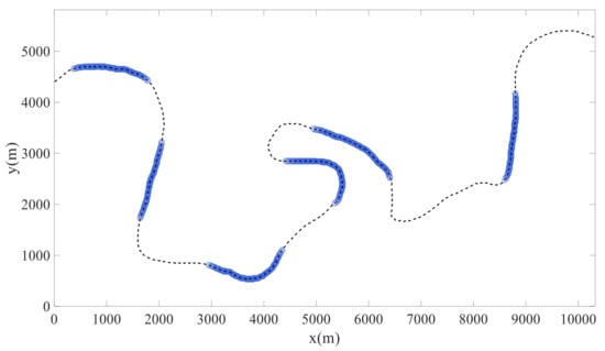
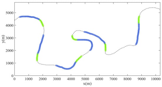
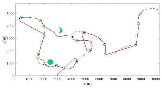
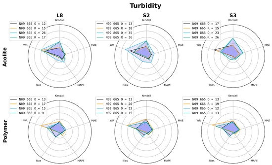
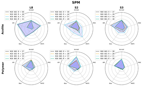
This article extracts the Qiantang River tidal bore, analyzing the water environment characteristics in front of the tidal line of the Qiantang River tidal bore and behind it. The Qiantang River tidal bore Index (QRI) was established using HY-1C, HY-1D, and Gao Fen-1 wide field-of-view (GF-1 WFV) satellite data to precisely determine the location and details of the Qiantang River tidal bore. Comparative analyses of the changes on the two sides of the Qiantang River tidal bore were conducted. The results indicate the following: (1) QRI enhances the visibility of tidal bore lines, accentuating their contrast with the surrounding river water, resulting in a more vivid character. QRI proves to be an effective extraction method, with potential applicability to similar tidal lines in different regions. (2) Observable roughness changes occur at the tidal bore location, with smoother surface textures observed in front of the tidal line compared to those behind it. There is a discernible increase in suspended sediment concentration (SSC) as the tidal bore passes through. (3) This study reveals the mechanism of water environment change induced by the Qiantang River tidal bore, emphasizing its significance in promoting vertical water body exchange as well as scouring the bottom sediments. This effect increases SSC and surface roughness.
Full article
(This article belongs to the Special Issue New Developments in Remote Sensing for the Environment II)


